Staweford: Routeways and meeting places in North Northumberland

View looking northwards towards Staweford (near the trees in
the middle distance). Image (C) Google Earth
Over the last couple of years, due to my involvement with the Gefrin Trust, I’ve been increasingly thinking about the Anglo-Saxon palace site at Yeavering, which lies on the River Glen in North Northumberland. It is usually described as being on a side valley opening out onto the fertile soils of the Millfield Basin. However, I’ve always had a bee in my bonnet about the importance of Glendale itself as routeway. Today, almost all visitors to the site arrive from the east driving down towards Kirknewton having turned off the A697. Very few people keep on travelling past Kirknewton following course of the Glen, which becomes the Beaumont Water in its upper reaches. Ultimately, this routeway crosses the Scottish Border and reaches Kirk Yetholm. From here it is easy to strike north-west towards the Tweed at Kelso or head westwards along the course of the Kale Water to the River Teviot and Jedburgh (site of an important Anglo-Saxon monastery). It is clear that despite appearances when viewed from Yeavering, Glendale is very much not a dead end
Yet, although I’ve always been convinced of the importance of this routeway up Glendale, I must admit, I’ve never been able to take this beyond a vague hunch. However, recently whilst researching something entirely different I’ve come across evidence that seems to corroborate the importance of this Beaumont Water axis. I’ve been reading up about the landscape of Northumberland during the 16th century, a period that was the high-tide of the endemic lawless border reivers. At this time, the Anglo-Scottish borders saw endemic livestock raiding and feuding between various extended families that lay both sides of the frontier. This violent society, despite its lawless nature, did have its own rules and regulations. Amongst these were formalised meeting and assembly points, where business and legal proceedings could be conducted under a temporary state of truce.
I’ve been trying to identify and understand these locations, partly because I’m interested in the 17th century landscape of the region, but also because I’m interested in whether a better appreciation of the Tudor landscape of assembly and gathering might provide a window into similar practices in the region during the early medieval period. I obviously owe an appreciation of the potential of this approach to work that has been done in Durham on early medieval assembly places by Sarah Semple and Tudor Skinner.
Anyway, I’ve been working my way through the wonderful, but dense, Calendar of Letters and Papers relating to the affairs of the Borders of England and Scotland preserved in Her Majesty’s Public Record Office, London (1894), which brings together much of the important and extensive document record from this region. Amongst these documents are repeated references to an meeting place at a site called Staweford or Stawford. These meetings were between the English and Scottish wardens of the Border Marches and where Warden courts were held. An initial search via the OS Gazetteer produced no location for this site. However, a bit more poking around showed that Staweford was recorded as a point on the Anglo-Scottish border in a survey of 1604; and it was clear that it lay close to where the Halter Burn met Countrop Sike, close to Yetholm Mains (NT884 292) – which lies, pleasingly, on precisely the routeway between Yeavering and Kirk Yetholm. The presence of an important meeting location at this site does seem to imply that this was an important communication route and not an isolated backwater. Certainly, other known meeting sites of this type were also on major routeways, such as Carter Bar, still one of the main crossing points between England and Scotland.
 

Location of Staweford. Map (C) Ordnance Survey / Edina Digimap

The obvious next question is the antiquity of Staweford as an assembly point. It had its importance in the 16th century as a location where England met Scotland. Given this point only emerged as national border some time before the 13th century, it might at first seem unlikely that it was important in the Anglo-Saxon period. During the Anglo-Saxon period, this area seems to have been part of a composite estate comprising a series of townships lying along the Beaumont Water that probably had its estate centre at Kirk Yetholm. These villswere recorded as gifts to the monastery at Lindisfarne given by King Oswiu in the later 7th century. The overall estate seems to have been split up in the 12th or 13th century with most vills staying in England with a western rump ending up in Scotland. It seems then that the boundary on which Staweford sits was not originally of a large estate or early ‘shire’ but may possibly have been a boundary between two villswithin a putative ‘Yetholmshire’ (see Colm O’Briens paper in Archaeologia Aeliana 2002 for more discussion of this).

There is one more piece of information to bring into play. Whilst, Staweford may have been a crossing point over a relatively small stream, possibly dividing two units within a larger early medieval estate, it was not an entirely isolated location. There are records of a small chapel standing close to the site, although this has now disappeared. Intriguingly, it was recorded as being dedicated to Ethelreda – this is probably the same as Etheldreda, better known as Æthelthryth, a 7th century Kentish princes, who married Ecgfrith, King of Northumbria, in 660, but subsequently returned south to found a monastery at Ely. On her death she became an important Anglo-Saxon saint. It is just conceivable that the dedication of this chapel could go back to a relatively early period in the centuries after the land was gifted. This might indicate some early importance to the site, although the dedication may of course be much later.

So in conclusion, the presence of a 16th century meeting place at Staweford does seem to vindicate my hunch about the importance of the Beaumont Water as a routeway into the Tweed and Teviot valleys from the Yeavering area. However, it is not easy to be certain how much earlier the importance of that particular location can be pushed as an assembly point. A most likely origin date is the 12th/13th century when it became the Anglo-Scottish border. The Ethelreda dedication of the chapel might just hint at an earlier origin, although its importance may have been far more local at this earlier stage.

"Oh, is the water sweet and cool, Gentle and brown, above the pool?" Landscapes of swimming

I’ve just had a great weekend down on my home turf in Wessex which involved a fair amount of sploshing around in water: paddling in the icy cold crystal-clear waters of the Test in Hampshire and wallowing in a bathing hole near the source of the Thames in West Oxfordshire. As ever, I kept my archaeological head on and got to thinking about the landscape evidence for swimming. I don’t mean the rise of the public swimming baths, pools and lidos which flourished following  the 1846 Public Baths and Wash-houses Act; there has certainly been lots of work on the architecture of these structures. Nor was I thinking about sea bathing which developed in popularity over the 19th century, rather I was pondering how swimming in fresh water, or what is now rather archly termed ‘wild swimming’, mucking around in rivers, ponds and streams might leave a landscape trace.
Obviously, much of the immediate impact is ephemeral, there are scrapes and erosion patches on river banks showing where people got in and out of the water. There are also the inevitable scrappy lengths of rope tied to trees, by which teenagers and those who still think they are teenagers can get their Tarzan fantasies out of their system. It is unlikely that these would survive in the long-term in the landscape record, although presumably it is this kind of simple set up that characterised the bathing places of the medieval and early modern world, everything informal and ad hoc. However, poking around a little it is clear that there is in fact a more substantial and developed landscape of freshwater swimming.


Parsons Pleasure c.1870
Parsons Pleasure c.1950
I’ve only looked at a rather small area, the middle and upper Thames in Oxfordshire, an area I know fairly well and it is where I’ve done most of my river swimming. A quick look at the map though reveals a multiplicity of bathing places in and around Oxford. In some cases, these were clearly quite informal , whilst in others quite considerable infrastructure developed. Perhaps the best known site is Parson’s Pleasure – a bathing place on the River Cherwell in the University Parks, which became well known as a place for nude bathing and was frequented by dons and students in the 19th and 20thcentury. The area was reserved for men, and was located on an ostensibly easily bypassed branch of the river. It was an area rich in University folklore- allegedly a female student accidentallypunted passed a group of naked lounging dons. All but one cover their privates, but the classicist Maurice Bowra covered his face instead stating “I don’t know about you, gentlemen, but in Oxford, I, at least, am known by my face”. From the 1930s a nearby area was used for naked bathing by female students and was known a Dames Delight. Although Parsons Pleasure started as an informal and undeveloped location, by the mid-20th century there were changing rooms, and the area was screened off from prying eyes by formal fencing.

Long Bridges Bathing Place c1950
Whilst, these two sites were clearly rather exclusive areas intended for the use of the Gown, the Town were also well provided with formal bathing places – Tumbling Bay (off the allotment on Botley Road), Long Bridges (near Donnington Bridge), Wolvercote and St Ebbe’s all had their own bathing places which were provided with varying levels of infrastructure. Tumbling Bay had changing rooms, weirs to manage the level of the formally landscaped pool, flower beds and ladders  These were clearly for the use of the general population of Oxford – St Ebbe’s for example, was before its clearance, one of the town’s largest slums. Indeed, many of these places seem to have been at least partly managed by the council before they closed them down in 1990s. Doubtless they were seen as cheap and easily maintained public services, less complex to manage and maintain than formally built lidos. [for more on the bathing sites of Oxford and what remains there now have a look at the great Dereliction in the Shires website )

Wolvercote bathing places – (C) Picture Oxon


It is perhaps not surprising that Oxford has so many river bathing locations- it’s a university town with many channels and watercourses braiding through it. Crucially, there were relatively few large industries chucking effluent into the water. However, it was not only in places like this that there were formal bathing places. I’ve fortuitously stumbled across a similar development in a small village just a dozen miles away. West Hanney lies on the Letcombe Brooke, one of the slow flowing tributaries of the Ock in the Vale of the White House. Not surprisingly, the river was used to power mills and for quenching the thirst of the inhabitants and their livestock. But in the later 19th century, a small formal bathing place was constructed on the brook. It seemingly comprised a corrugated iron enclosure, basic changing rooms and a veranda, whilst the stream was widened and provided with a concrete base. The local mill just downstream was able to maintain the level of water to allow swimming. This bathing place was paid for by the inhabitants of West Hanney and neighbouring East Hanney and was popular until in the early years of the 20th century there were allegations of ‘indecencies’ and its use was kerbed before it was finally destroyed by a flood in the 1940s. I only stumbled across this by chance, it is probable that many more such small-scale swimming holes must have  constructed and used in the 19thand 20th centuries, which would only be picked up by detailed exploration of OS maps and local histories.

Bathing place, West Hanney – late 19th century


A final dimension to these landscapes of swimming are the memorials to the occasions when things went badly wrong. Not surprisingly, it was not uncommon for people to drown, particularly when swimming near weirs or areas with strong undertows. In some cases, memorials were erected to them at or near the place of their demise. Perhaps the best known example is the obelisk erected on the weir at Sandford, just south of Oxford. Known as the ‘Sandford Lasher’ this weir was notoriously dangerous. The obelisk records the deaths of five students from Christchurch college who had drowned there in the 19th and early 20th century including the adopted son of J.M. Barrie. Another monument stands on the Thames between Folly Bridge and Osney Bridge commemorating Edgar Wilson, an assistant chemist, who died saving two boys who had got into trouble in the river in 1888.
 In the later 20th century swimming in natural watercourses went out of fashion, as worries about health and safety peaked in – and many children of my generation will remember being freaked out by the ‘Darkand Lonely Water’ public information films. It’s only recently that there has been renewed popularity in ‘wild swimming’ partly stimulated by Roger Deakin’s Waterlog. But these swimming sites are really interesting and neglected aspects of social history,that could do with some more research. Apart from anything as the worries about public decency at West Hanney and the ever-so-genteel hints of homosexuality associated with Parson’s Pleasure, these were places were the combination of nude swimming and young (and not so young) people meant that there were undoubtedly pretty strong sexual and gendered undercurrents to what went on.  The scene in a EM Forster’s Room With a View in which Mrs Honeychurch, Lucy and Cecil Vyse encounter the group of male characters bathing in the nude is just a hint of the kind of chance and planned encounters that must have happened at such sites. It would be wonderful for someone to start trying to record these sites, before they are lost to memory and nature.

A pilgrimage to Iona: first thoughts

 Last week I finally made my first visit to Iona. Having spent so much time writing and thinking about the archaeology of Lindisfarne, it is natural that I had to eventually go back to the source of the monasticism on Holy Island. It was fantastic to make my first foray to the island from where Oswald brought Aidan and other monks to found his new Northumbrian monastery. No matter how much one looks at plans and photographs there is nothing that beat actually visiting a site to get the sense of its human scale and proportion. Exploring some of the island has been incredibly useful in helping me rethink the archaeology of Lindisfarne and also raises some questions for me about the archaeology of Iona.

Like my medieval predecessors, the journey to Iona for me was very much a pilgrimage, and included the classic elements of a devotional exploration. I cast off family attachments (or at least made sure they were settled in the chocolate café in Tobermory), carried out a long journey facing many adversaries (primarily getting past the lunatics who holiday in Mull in mobile homes the size of buses) and finally reached Fionnport to catch the ferry. Here I stepped away from my final connection to the real world (or “parked the car” as some might term it) and joined the small group of hardy visitors waiting in the driving rain for the Calmac ferry.
At this point, it’s worth emphasising that my visit to the island was not as long as I could have hoped for; the shocking weather and the need to preserve familial harmony meant that I was only able to spend a few hours on Iona so this account is by necessity impressionistic rather than thorough.
Although my interests are primarily early medieval, I was surprised to be seduced by later medieval archaeology of the island. Although heavily reconstructed, the abbey church was wonderful with some vibrant and quirky historiated capitals. I also fell in love with the intimate little cloister, an antidote to the larger cloisters I’ve experienced in Durham and the great Cistercian monasteries of the Yorkshire. Smaller monastic houses such as Iona would have been much more typical of the vast majority of medieval monasteries in Britain, and certainly similar in scale to Lindisfarne Priory.
I was also smitten with the later medieval tradition of carved stone working – the continued use of interlace on recumbent grave slabs and some crosses, such as the still-standing Maclean’s Cross and the more fragmentary 15th century cross of Lachlan MacKinnon with its plant scroll with its echoes of Northumbrian vine-scroll carving of a far earlier period. There was also an impressive later tradition of figural representation on burial monuments, seen on the effigies of the abbots in the church and the bullet-headed knightly effigies originally from Reilig Odhráin, which reminded me of the confrontational knights of the Lewis Chessmen. There was also the regularly appearance of the birlinn (sailed galley) motif, a potent reminder of the importance of control the seaways in this region. My personal favourite though was the memorial slab of the redoubtable looking Prioress Anna MacLean in her pleated cassock.
Having a chance to look at the earlier carved stone was also instructive, particularly getting the sense of scale of the high crosses. It was also exciting to get a sense of the wide range of different stone types being used for carved monuments, many not coming from the island itself. This is strategic use of stone types is something that Adrian Maldonado has commented on and also keys in to something we are starting to recognise in Northumbria. However, it was looking at the wider landscape that I found most instructive and for sake of brevity I want to focus on two particular aspects of this.
The first issue is the impressive earthwork vallum that surrounds the monastic core. In the literature this is one of the most distinctive features of Iona. On the plans and aerial photographs that are the most usual ways of encountering the plan of the site, it comprises a large well-defined earthwork that runs along the western side of the site as a bank and ditch and can also be seen as a cropmark to the north. Yet, when you are actually on the site, it is very hard to discern this boundary, primarily because for the observer within the monastery it is largely hidden from view by a series of rocky outcrops, Cnoc nan Cárnan that run parallel with the western side of the vallum, as well as two enclosures Cill mo Neachdain and Gill mo Gobhannan. Whilst the latter two features are of uncertain date and may not have impeded an early medieval view of the ditch and bank, Cnoc nan Cárnan certainly would have. In many ways it is this rocky outcrop that serves to define and I think significantly, constrain, the views from the monastery rather than the actual vallum. It means that Iona is a site which like Lindisfarne looks towards its shoreline, and like Lindisfarne, this nearest shoreline is not a wild ocean vista but the more constrained landward view.
I also remain puzzled about the origin of the vallum. Whilst long thought to be early medieval, more recently it has been dated to the Iron Age by a C14 date of 40BC to AD220 from a sample taken from under the bank. As Adrian Maldonado has noted, we do need to exercise a little caution here – technically this only provides a tpq for the construction of the vallum rather than a construction date itself. However, if for sake of argument we accept an Iron Age date for this large bank and ditched enclosure then this for me raises as many questions as it answers. My biggest qualm is that this large enclosed area looks so very different from most common types of enclosures we know are used in Argyll and the Inner Hebrides in this period, where the most common settlement type is the far smaller dun. A good example is Dùn Cùl Bhuirg that lies on the western side of the island which only encloses an area c.45m x 35m. Crucially, both duns and the larger Iron Age forts tend to utilise hills and defend the summit. The situation is very different at Iona where the boundary seems to enclose a relatively low-lying rather than elevated area. I admit to not being an expert on Iron Age enclosures in Argyll, but if we accept that the vallum is Iron Age in date, we are faced with a new problem, a seemingly a-typical and rather large enclosure preceding the establishment of the monastery. It is surprising that despite the large number of interventions within the enclosure, none have produced any clear Iron Age material culture (apart from a glass bead that could equally be early medieval and a fragment of Roman samian), whereas the relatively small-scale excavation by the Ritchies at Dùn Cùl Bhuirg produced midden material, decorated Hebridean wares and some beads. So, in essence, what is this putative Iron Age enclosure?
My second area for consideration focuses on the relationship between Iona and Lindisfarne in landscape terms. It is generally accepted that Oswald’s decision to construct a monastery on Holy Island must have been influenced by his experience of Iona during his time in exile in Dal Ríata where he converted to Christianity. It is axiomatic that the planning of monastic sites was in some ways at attempt to reconstruct on earth an idealised model of Jerusalem, It is no coincidence that Adomnán, one of Iona’s most important abbots, was the author of De locis sanctis (Concerning sacred places), a description of the holy places of Palestine, including Jerusalem and Bethlehem. However, exploring Iona also got me to thinking about the way in which Lindisfarne was an analogue for Iona. In many ways the geography of the two islands is very different; Iona is far rockier and has greater relief than the generally low lying Lindisfarne. The latter is also, of course, tidally accessible rather than a true island like Iona. Yet, there are some really interesting parallels both in terms of physical geography and planning. 

My first observation on this front brings me back to my earlier comment about the use of a range of stone types. One of the most distinctive features of Fionnport, Iona and the Ross of Mull is its very highly visible pink granite; Lindisfarne, whilst not having pink granite, does have outcrops of pin-red sandstone in the area around the site of the early medieval monastery, something that would not have gone unnoticed by visitors to the two islands.

Despite the difference in relief between the two islands, Lindisfarne is not entirely flat and the distinct jagged ridge of whinsill basalt that runs across the south of the island is an important part of the landscape. In particular, part of this crag, known as The Heugh, lies immediately adjacent to the site of the early medieval monastery. Visiting Iona I was impressed by the similarity in terms of positioning between The Heugh and the slightly smaller but nonetheless imposing Tòr an Aba which lies to the west of the abbey at Iona. This latter feature was traditionally associated with the cell of Columba described by Adomnán as ‘built in a higher place’. Excavation revealed a stone footing and a cross-base created partially out of re-used millstone. This reminds me of the presence of a cross-base lying on The Heugh which also lies on an artificially created platform. More recently, this summer, archaeological excavation on The Heugh also uncovered possible early medieval structures elsewhere along the ridge.  The geological parallels between the Heugh and Tòr nan Aba, as well as the use of crosses to mark them are at the least intriguing.

 A final interesting similarity is the presence (or former presence at least) of a lake on both islands – Holy Island lough lies in the north-east corner of the island, whilst the site of the Lochan Mór lies to the north-west of Iona Abbey, although it had been drained by the 1750s. It had once had an outlet which ran through the monastic enclosure via the stream known as Sruth a’ Mhuilinn, which as the name suggests mayhave powered a mill, although this is not certain. Intriguingly, a lack of pollen of from Holy Island Lough dating to before the late 7thcentury has led to suggestions that it was created or at least expanded at  some time in the early years of the monastery on Lindisfarne. Whilst the most obvious explanation of this is the deliberate harnessing and consolidation of a water supply to power a mill, the expansion of a lake in the near vicinity to the monastery on Holy Island would have served to emphasize some of the similarities in the landscapes of Iona and Lindisfarne.
Obviously, the presence of particular coloured stones, the rocky outcrops and open water on both islands are co-incidental. Yet in an early medieval ecclesiastical mind-set primed to recognise analogies, similarities such as these are unlikely to have been seen as fortuitous, and may instead have had symbolic resonances. In a world where books, carving and landscapes were all read analogously, as well as literally, these correspondences would have been important. The parallel placement of crosses on The Heugh and the Tòr nan Aba suggest a conscious decision to emphasise these similarities, as less certainly does the expansion of Holy Island Lough. There is certainly scope for more exploration of the parallels and differences between Holy Island and Iona in terms of spatial organisation, but that is perhaps for a more extended piece of work.

I need to go back to Iona- there is still a lot of pondering to be done. I never got a chance to explore significantly beyond the monastic enclosure, I’m interested in the relationship between the island and both the sea and the mainland. My time on Mull and in some of the surrounding areas convinces me more than ever of the need of a proper hinterland survey of both Iona and Lindisfarne; whilst both sites are islands, they were not isolated and there is a real need to better understand their immediate and wider landscape contexts. So, with a small prayer to Columba and Cuthbert, I hope to be back soon.

The Living and the Dead (and the lack of a sense of place)

I’ve been watching the new BBC folk-horror production TheLiving and the Dead for the last month – it’s good; decent production values, often beautifully filmed, just this side of histrionic and tipping its hat to the ancestors (Wicker Man etc). I enjoy it, and I’ll watch the whole series. It’s just that something doesn’t quite sit right with me- I can’t seem to give myself over to it properly, and I’ve been struggling to work out why. It was watching last week’s episode, involving a blight on the wheat harvest that I finally started to twig why it wasn’t working for me. Enlightenment came when a song was played over a scene of the harvest. The song was a version of Reaper’s Ghost written in the 1930s by the US songwriter and musician RichardDyer-Bennet. My first reaction was “…but it’s not a pigging hayfield!” It was a wheat field – they are not the same thing at all. Hay is grass cut for fodder to feed animals; the scene was showing reapers harvesting wheat. Different crops, different times of year, different purposes. Now I’ll put my hands up and admit that it’s probably me being really petty – and that the point of the song was to give a suitably menacing ambience to the scene. Yet, it pointed to a bigger problem- that starts with the music, but is embedded in much of the rest of the programme.

Let’s start with the music – the title song is a version of the Lyke Wyke Dirge done by Bristol-based outfit The Insects. Again, a song with suitably menacing lyrics

“This one night, this one night,every night and allFire and sleet and Candle-lightand Christ receive thy soul”


It’s sung with a certain ominous hamminess – it’s fine. But, and this is a big but, the actual first verse (and forgive the phonetics) are

“This ane night, this ane night,every night and awle:    Fire and Fleet and Candle-lightand Christ recieve thy Sawle.”


Again, I open myself to charges of pickiness here- but the Lyke Wake Dirge is a song with a particular pedigree; it’s a northern song written in Yorkshire dialect, and recount the soul’s journey through purgatory and clearly has Catholic undertones. Yet The Living and the Dead makes great play of being set in Somerset. It’s a cracking song, but it’s completely decontextualized in as the title song. So, what about the other music used in the series? We hear The Brave Ploughboy – perfectly common folk song collected in the 19thcentury – no problem with that one. We also hear the tune of Bold Sir Rylas, again fine. But then it starts to get problematic- She Moves through Fair, an incredibly well known (indeed a little hackneyed) Irish song first collected in the early 20th century, then I am Stretched on Your Grave, another well-known Irish folk song, covered by many including Kate Rusby and Sinéad O  Connor – and crucially, the words and the tune were only combined from separate sources in the 1970s. 

Hopefully, you are getting my drift now- the music is cobbled together from old folk standbys which no doubt lurk somewhere side by side on Now That’s What I Call Folk Music 1. There is no sense of shaping or selecting the sound track; instead it feels that it’s a selection of folk standards that have been thrown together by people with no real engagement with folk music or the specific Somerset setting. This is a real shame, because Somerset has no shortage of its own excellently recorded folk tradition. Indeed, it was in Hambridge in Somerset that Cecil Sharpe recorded his first folk song “in the wild” – the Seeds of Love – from the gardener John England.  There has been no shortage of subsequent collection and research into the musical tradition of the county, I’d single out the work of Yvette Staelens and her Somerset Folk Map here.

This is all well and good; I admit I’m a folk music geek, and I’m probably hard to please. I’m admittedly perhaps not the target audience for the soundtrack. But what about other aspects of the programme’s mise en scene. As I noted above, the programme claims to be set in a specific part of the country, Somerset. The name of the village where it is set is Shepzoy  – and full marks here. That –zoy suffix is a genuine localised Somerset place-name element. It’s found in place-names such as Westonzoyland, Middlezoy  and Chedzoy. These are all found in the lower reaches of the River Parrett to the north-east of Langport. This is in the heart of the Somerset Levels – a distinct low-lying watery district characterised by many drainage ditches and channels, peat beds and wetlands. It’s an eery and unsettling landscape in its own right. Yet, none of this materialises on the programme. Instead, the landscape views (and there are lots of them) seem to be of rolling good quality wheat growing countryside – nary a fen or bog in view! Indeed, one episode a coal mine plays a part; although not well known, there was a Somerset coalfield, but this was well away from the levels and up in the north of the county. Once again, despite an attempt to localise the programme and embed it into a particular pays, it comes over as slightly tone deaf, managing to miss out detail, and not engaging with the reality of the human and physical landscape it claims to occupy. It is, in fact, filmed in South Gloucestershire, a very different landscape.

Now, not only am I a folk music geek, I am an archaeologist with an interest in historic landscapes- so not only not a good audience, potentially, the worst possible audience. I admit, I am probably being overly pedantic here- I am sure there are other things I could worry away at too (would a labour force as late as the 1890s been shocked by the introduction of a steam plough? ).

But I think the underlying lesson for me is that a good folk-horror needs to be genuinely sedimented into its landscape. Folk-horror as a genre arises out of a particularly English tradition of ghost story  and more broadly fantasy writing- figures such as MR James, Tom Rolt, R and Alan Garner are key here. In their writing, the stories are clearly situated in real, specific locations – drawing on existing exterior traditions and myths. MR James’ Burnstow in “Oh Whistle and I’ll come to you, my lad” is clearly based on Aldburgh or another small town on the Suffolk Coast. The landscape described in A Warning to the Curious is again clearly located in Suffolk. In other cases, he uses real locations-  St Bertrand de Comminges and Viborg – carefully slipping the plot lines into the interstices of real historical events and real people. The ghost stories of Rolt clearly draw on his knowledge of industrial archaeology and canals (for a good example read his ‘Bosworth Summit Pound’). Garner’s work which is situated more on the fantasy side of things than the supernatural, despite having some horrific elements within them, also has an incredibly strong sense of place. The brooding summit of Mow Cop (Cheshire) looms over the lives of the cast of Red Shift, whilst the plot of The Owl Service traces a plot drawn from the Mabinogion in a clearly described central Welsh location. In all cases, Garner, James and Rolt, these writers have researched deeply into the traditions, landscapes and practices about which they right. Their writing is organic and situated and it would be hard to transpose the stories to other contexts without losing something important.

This interest in particular places, the folding of chronology and presencing of the past and the central importance of specific places and landscapes, for me, lodges this British folk horror/fantasy tradition firmly into the English Neo-Romantic movement, which springs from a particular sensibility that sees the past as something that it perpetually immanent in the present, particularly in rural contexts. In some ways, this taps into the notion of the ‘archaeological imagination’ as described by Michael Shanks, who describes it as the urge

“To recreate the world behind the ruin in the land, to reanimate the people behind the sherd of antique pottery, a fragment of the past… a creative impulse and faculty at the heart of archaeology, but also embedded in many cultural dispositions, discourses and institutions commonly associated with modernity. The archaeological imagination is rooted in a sensibility, a pervasive set of attitudes toward traces and remains, towards memory, time and temporality, the fabric of history” (Michael Shanks 2012 The Archaeological Imagination, 25).


It’s the emphasis on the fragment, the ruin and the trace that is reflected in the Neo-Romantic tradition – the ruins drawn by John Piper, the rural and industrial scenes of Ravilious, the aerial fieldscapes of Peter Lanyon. No matter how abstract, no matter how surrealist, they arise out of specific landscapes and monuments. It is easy to see then, how ghost stories and tales of supernatural key into this tradition. There is nothing that presences the past more clearly and explicity than the appearance of a ghost.


So to bring slightly rambling post back to the beginning, for me the failure of The Living and the Dead is in its’ failure to root itself into a real landscape and tradition. It misses an opportunity to engage with the real traditions and landscape of Somerset, something I would argue that would have given it more depth, more heft, and would, like all good folk-horror, allowed to linger and perhaps seep out into reality. There is an absence where there ought to be a real place. It’s this lack of attention to detail that ultimately disappoints. It’s fast –food folk horror, it meets a craving, but fails to sustain.

Notes from a small(ish) island #2: reflections

Reflecting on the experience of excavating on Holy Island, it struck me how much of my personal thoughts about the process revolved not about the archaeology as a physical resource or academic product, but the emotional side of excavation. The notion that archaeological site reports are far too dry, focusing solely on the objective record of the excavation (as far as that is ever possible) is not a new one – thinkers, such as Ian Hodder where commenting about this in the 1980s. But despite this, there have been very few attempts to actually try this out in practice. Even when excavators have been encouraged to be reflective and interpretative in their site records, this rarely makes it way through to final reports.
Surprisingly, despite the massive uptake in the use of social media (Twitter, FB as well as blogging), which ought to be ideal ways of capturing peoples’ immediate emotional and personal reaction to excavation, it rarely seems to be used in this way. Possibly so many of us have the importance of using social media as a shop-window for our projects drilled into us, using them as an extension of the media and PR process, that we are cautious about putting anything too personal. We might be happy to share excitement about the project or an important find, but we are perhaps too careful about expressing doubts or uncertainty or even owning up to mistakes. Social media can be harsh and unforgiving, so it is perhaps not surprising that we often try and carefully police how we use it. Given this, it is perhaps not surprising, that whilst on site on Holy Island, I was quite happy to tweet when we found our best finds, but less inclined to comment on the more personal moments on the project. Now I’m out of the field, back in the ‘real’ world, I thought it would be useful to perhaps reflect on some of these less tangible aspects of the excavation experience
As co-director and academic lead, one of the over-riding feelings I felt was the pressure to ‘find something’; in our case, the remains of the early medieval monastery. It’s an archaeological axiom that negative evidence is as important as positive evidence; the failure to identify clear early medieval remains in any of our trenches would not, technically, have been a failure. It would have allowed us to strike off certain areas in our quest for the Anglo-Saxon site and to focus on others. Indeed, as this year’s work was essentially a site evaluation, this was the precise purpose of the dig.
But we’re all human – it’s inevitable that we want to fulfil our quest straight away. In the case of any research dig, there is the underlying urge to uncover something to justify the expense and time spent on setting up the project. Given the particular configuration of our project, overwhelmingly supported by crowdfunding, that pressure magnifies. As part of the crowdfunding process, we have to spend a lot of time emphasising the excitement and potential of the site – we have to talk the site up in order to persuade people to invest in it. Crucially, that investment doesn’t just come in the welcome financial form; there is also an immense emotional investment in the project by our supporters that comes before their decision to put money into it. For some, their small investment just means they are following progress virtually via social media and the internet – they may be disappointed if we fail in our objectives, but it’s wouldn’t be a big disaster. But for those who contribute enough to come and dig, the personal investment is much more. As well as contributing directly to the dig, they will have taken time out of their lives and holiday allowances to be with use; they will have spent money on accommodation and travel. Whilst most, if not all, appreciate that archaeology has an element of luck and are hopefully coming into the project with their eyes open, it is very difficult not to feel the pressure to somehow repay their confidence and excitement in the whole exercise.
Obviously, we do a huge amount to try and avoid empty trenches – in our case, we were homing in on features picked up in our previous geophysical survey, so we had clearly identifiable targets. We’d also looked at other excavation results from both the island and similar sites elsewhere to get a sense of what we might find in practice. But, at the end of the day, there are two things we can’t control – the archaeology itself and the weather, and ultimately, luck plays a huge part.
I’d already experiences the vicissitudes of luck on my previous project at the Roman fort at Binchester, where we entirely unexpectedly stumbled across an incredibly well-preserved Roman building with walls 2m high. This was a wonderful find, but we can’t claim any real credit – we didn’t know it was going to be so well preserved, it was a happy accident. Indeed, in many ways, if we’d known how it was going to turn out, we would have approached the entire project in a very different way. Nonetheless, we ended up with a stunning site and lots of impressive finds.
An early medieval monastery is a very different beast to a Roman fort though in archaeological terms. Sites like Binchester are packed with easily visible floors and walls and are heavy on finds. Early medieval sites are usually far more ephemeral with very low levels of material culture. In many ways Binchester had spoiled me for archaeology – even though I knew academically that even well-preserved remains of Anglo-Saxon Lindisfarne would be far less impressive than the site at Binchester, it was hard not to feel a sense of disappointment during the initial topsoil strip.
Topsoil strips are the moment of truth- the point when all your investment, emotionally and in resources, finally confronts the raw friction of reality. It’s only when the turf is removed and the ploughsoil taken away that you finally confront what you hope will be your archaeological site. Perhaps inevitably, I want these to be ‘ta da!’ moments, when the cloth is whipped away to show you a perfect and immediately understandable site. As the digger bucket first went into the soil in Sanctuary Close, I felt physically sick, although there was the inevitable bravado and banter covering it up.
In practice, when both our trenches in Sanctuary Close were finally opened up, I felt rather underwhelmed. Despite the suggestions of our geophysical survey, there were no clear structural remains of the type I’d secretly hoped for, nor were there any immediately obvious finds. For the first couple of hours, I had this horrible feeling that we’d opened up onto natural. We’d got all the people and spent all the money for nothing! Again, whilst I knew intellectually that we still needed to give the trenches a good clean down and that our geophysical survey was unlikely to be completely wrong, the initial impact of a messy trench with no obvious archaeology is a scary one.
One of the things that actually calmed me down the most was that evening, when I got the opportunity to read an unpublished synthesis of Charles Thomas’s many interventions on Iona – a site as similar to Lindisfarne as it is possible to get, and with which Lindisfarne was deeply entwined historically. It was a relief to see that many of Charles Thomas’ interventions had failed to find anything of import, either hitting natural or clearly post-medieval features – if even CT could repeatedly not hit archaeology on an site that is packed with as much archaeology as Iona, then us letter mortals needn’t feel too bad if we missed paydirt with our first trenches.
But over the next day as we started to clean back the remaining top soil, cleaning and clarifying, things did slowly come into focus. Instead of the undifferentiated background noise of rubble and silt, things started to coalesce. No, there weren’t any obvious structural remains, but in Trench 2 we started to pick up bone, probably human, embedded in our rubble spread. It was clearly not natural – whatever our spread was (and we still aren’t sure) it was anthropogenic – it was archaeology! The same was true in Trench 1 were we soon found a small flagstone surface.
The next struggle I found was how to approach this material. Whilst in an ideal world, every site would be approached in more or less the same way, in practice there are lots of pragmatic decisions to be made, informed by resourcing and logistic issues (limited time; limited people), as well as by the nature of the archaeology itself. Early medieval structural remains can be very ephemeral and not easy to identify – I was terrified of accidentally knocking through important remains and missing them entirely. As a consequence we spent a long time ‘tickling’ the rubble spreads, cleaning and recleaning, hoping that we would see something emerging. Yet, we got nothing structural – we certainly found more disarticulated human bone and, fantastically, two fragments of Anglo-Saxon sculpture, but the rubble wasn’t resolving itself into anything. Finally, we decided to be a bit more vigorous with it; not mattocking through it with gay abandon, but certainly making a decision to be more vigorous with our trowelling and using the mattock in a targeted way. Suddenly, particularly in Trench 2, features started to appear, stone settings, possibly gullies began to emerge. We’d finally hit our stride. Ironically, we’d had exactly the same process at Binchester, where because we were so nervous of missing ephemeral sub-Roman occupaiton, we spent much of the first season cleaning and planning what I am now certain, were simply plough-sorted pebbles.
I think the beginning of every site, one goes through this ‘sizing up’ process – what’s the soil like? Does it respond to cleaning? Can you get straight sections (“section perfection”) and nice flat surfaces? How does it respond to too much rain – and not enough rain? Frustratingly, with our Sanctuary Close trenches, it was only in the last couple of days of our short season that I felt we were really starting to get the measure of the site. This is, of course, precisely the purpose of archaeological evaluation, you are trying to measure the survival of potential remains, qualitatively and quantitatively, nonetheless, it can be a trying and stressful process.
There are also other things one is trying to assess in the early stages of a project- not just the archaeology but also the people. I was working with a great team – some I knew quite well; others were new to me. At the same time as one is trying to get the measure of the archaeology, there is the need to get the measure of your colleagues. Wonderfully, we all got on really well (I think!) and rubbed along fantastically, but it always takes time, particularly when you are all on top of each other sharing a dig hosue, to suss out people’s natural rhythms, enthusiasms and strengths – who needed coffee before they could function in the morning and who could leap straight out of bed and be onto their laptop within minutes.
Perhaps the biggest pressure I felt with people was not from our team , but from the many visitors. Digging on such a high-profile site, with such a high-profile lead-in campaign and with trenches physically straddling one of the main footpaths on a busy tourist honeypot meant that we had lots of visitors. Many planned in advance, others turning up on spec- as well as a huge number of questions and comments from tourists and the island’s inhabitants. All needed to be dealt with – all needed to be taken seriously and engaged with an enthusiastic and courteous way. The islanders were our hosts, the visitors and tourists included current and potential future crowdfunders and future generations of archaeologists, whilst our academic visitors included possible referees for future grants applications, project partners, not to mention my in-coming Head of Department. Despite all the planning ahead, dealing with these interactions took far more of my time than I’d anticipated – it was certainly far more intensive than we’d every had at Binchester. It caught me unawares – I also found the constant interaction, alongside the communal nature of dig life, physically very tiring, far more than the excavation itself, which I ended up doing far less of than I’d hoped or planned .

Throughout the project there were lots of other challenges for myself and the project team – some obvious- dealing with the media, the weather and the tides – and others more unusual what do you do when your drone is being mobbed by oystercatchers? How do you cope with having a circus tent five metres from one of your trenches for a weekend? How do you get your gazebo out of a tree after a sudden squall? Yet, it’s these kinds of anecdotal observations and personal perspectives and memories that so rarely make it into the final site report. Hopefully this blog entry can at least stand in until the final monograph!

Notes from a small(ish) Island #1

 After three days on Holy Island I’ve finally found a chance to sit down and pull my thoughts together. I’ll write about the academic content of the project at a later date, but I want to explore the more personal side of things first. Being involved in a new project is an exciting but nerve-wracking experience. The new work on Lindisfarne has the added challenge of working with new partners and a new team. Although we’ve only finished our first proper day’s excavation today (Monday), most of us have been on the island since Saturday afternoon. I’ve known Brendon and Lisa from DigVentures for a while, but I’ve not previously met the rest of the team; there’s new names to learn (and forget) and with any new group of people, there is always that cautious process of getting to know individuals and tentatively working out the social and personal dynamics. Happily, everyone seems to get on well, but with a big group in a small dig house, the scope for tensions revolve as much around getting the washing up done and taking muddy boots off, as the practicalities of the archaeology.

The first day, Sunday, was mainly taken up with getting everything set up – the dig ‘incident’ room was made ready, we got some training on the new GPS, and I gave everyone an overview of the island’s history and archaeology. There is also the important process of getting to know the island- where does the best coffee? [Pilgrim’s Coffee House] What’s the best beer in the Crown and Anchor? [Secret Kingdom] What on earth is ‘broon fish’? [battered smoked haddock!] Anyone who has ever been involved in a running a dig will also be familiar with the almost obsessive checking of weather forecasts and looking fretfully at cloud cover. Visibility during my walking tour of the island was so poor, we couldn’t even seen the mainland, let alone the Farne Islands or Bamburgh Castle.
On Monday, we finally began the topsoil strip. Watching the JCB slowly take off the topsoil and the bucket reveal the first site of underlying layers there is always a sense that this is the moment of truth. Truthfully, I always veer between wild optimism and complete pessimism. Particularly in a crowd-funded research excavation, one can’t help feel the pressure of expectation from the dig team and the other supporters of the project. It’s hard not to feel a little disappointed when the strip fails to reveal perfectly preserved, clearly early medieval structural remains, even though you know this was never going to happen.
Happily though, there are ‘things’ to be seen; there are confused patches of rubble, spreads of shell and clusters of stone hinting at walls or floors. We don’t yet know their date or function, but there is a sense of relief that we do have something and the volunteers willhave something to excavate over the next fortnight.
Today, finally we started with the main dig team, mainly comprising our crowd-funders, but also a handful of Durham students. Again, there are new names to get to grips with and new dynamics to work out. Some have dug before, some have never been on an archaeological site in their lives. Once we get them in the trench, we start to see their different approaches. Some people are nervous and tentative, worried they’ll damage the archaeology. Others can’t wait to get properly stuck in and move spoil on a large scale. We need to chivvy the slow one and reign in the enthusiasts. Slowly, but surely, the surfaces start to get cleaned and finds made. Some pottery is clearly 19thcentury, but some looks earlier, perhaps medieval; there are bits of animal bone, and excitingly a couple of human teeth. There is enough coming up to keep people enthusiastic and engaged during the long afternoon.
One of the distinctive aspects of this project that is already making itself apparent is the public engagement. One of the main footpaths across the island is straddled by two of our trenches. There is a large footfall, with almost all the passers-by stopping, even if only briefly, to look over our fences. Some just stare and move on, others leap in with questions- what are you looking for? Why are you digging here in particular? How long are you here for? Most are visitors, but we’ve lots of interest and support from the islanders too. As the day goes on, we really start to appreciate the challenge of talking and engaging with all the people interested in our work, whilst also keeping an eye on volunteers and the archaeology itself.

Tomorrow, we’re back in the trenches, the project will start to get into its rhythm. Workers will know where to go, who to speak to when they are stuck – the dig will start to hum.

Archaeology Blogging Carnival- Grand Challenges Part 2: Lives in the Landscape

Haymaking- Tristram Hillier (1943) (C) York Art Gallery
 a landscape without people
This is the second of my two contributions to the Archaeology Blog Carnival which is asking us to outline what we think are the grand challenges for our field of archaeology. I’ve already written one entry outlining one of the big challenges I envision for the archaeology of early medieval Britain, my main academic stamping ground. However, like a lot of archaeologists, my wider interests span traditional chronological divides. Over the last decade or so I’ve become increasingly interested in post-medieval archaeology, particular the 18th and 19th century.
A lot of the current research on the archaeology of this period focuses primarily on urban and industrial sites. This is for a number of reasons; firstly, there is a long tradition of industrial archaeology as an independent sub-discipline, originally focussing on technological history but increasingly expanding its focus to encompass the wider social context of industry. Second, much of the actual excavation on later post-medieval sites tends to be carried out in a development-control (cultural resource management) context, which widely occurs on urban and brown-field sites, for example, the important work by the York Archaeological Trust on the former Victorian slums at Hungate.
When it comes to the rural archaeology of this period the situation is very different. Despite there being a very well-established tradition of landscape archaeology in Britain, which can trace its origins to the work of pioneers such as WG Hoskins, this does not engage as extensively with the post-medieval period. Crudely speaking, the amount of work carried out trails of significantly in the post-Enclosure era, once the medieval common fields have been parcelled up, a process which was more or less complete by the early 19th century (although it did carry on later than this). This landscape approach largely draws on field survey and analysis of documentary and cartographic sources with relatively little excavation. In fact, when I was carrying out an audit of post-medieval archaeology in north-east England for the local Research Framework, I could not find a single example of an excavated post-medieval rural building in the region.
The danger of this landscape approach is that it is easy to lose track of the people, particularly the rural poor or indeed anyone except estate managers, farmers and land-owners, the people who make the decisions about how landscapes are shaped. Even this group often end up being viewed as passive pawns of wider social processes (high farming- enclosure- agricultural depression) – although I would single out the really useful fine-grained analysis of 18th and 19th century landscape and farm development in Northumberland by Ronan O’Donnell as an exception
What we are missing is any attempt to really explore the lived lives of rural workers (and I’d include within this category the population of small country towns). To get a sense of the richness of day to day life that we are missing read Flora Thompson’s Larks Rise to Candleford, her account of growing up in the North Oxfordshire countryside in the late 19th and early 20thcentury. Although it has acquired a rather ‘chocolate box’ reputation (not helped by the recent execrable BBC adaptation), it is actually far grittier than many people give it credit for. Reading it, one gets a first-hand sense of the complexity and light and shade of rural life. It talks about poverty, agricultural wages, food, music, employment, upholding traditions and breaking the law. The same can be said about Laurie Lee’s Cider with Rosie which deals with a marginally later period in the Cotswolds. Both books are of course literary creations rather than ethnographic studies and suffer from selection and omission (a bit like the archaeological record…). Nonetheless they are first-hand accounts of rural society which put lives in the landscape.
Family outside their cottage, Uffington- 1916
Henry Taunt (C) Oxfordshire County Council

My grand challenge for archaeologists is to try and encompass the complexity and fullness of rural life in the post-medieval period. We have no shortage of material, yet so it is so little exploited. For example, the grave yard survey is a staple of local heritage societies and student projects, yet I have come across very few studies that have attempted to combine the rich data about burial derived from these surveys with local census data, which can tell us about the status, profession and place of residence of those buried in the churchyard. This could then be combined with building recording which can tell us about their domestic space and even excavation, which has the potential to address patterns of consumption and production. If one was careful with the selecting the right village, there may be many other resources available, such as estate records or photographic records. For example, in an area close to my heart, the Vale of the White Horse in North Berkshire, there is a great photographic legacy through the work of the late Victorian photographer Henry Taunt, the collections of rural artefacts made in the first half of the 20th century by Lavinia Smith, records of folk traditions and folk songs (including some made by the noted archaeologist Stuart Piggot who retired to Uffington). There is ample scope for a truly holistic study of rural life that goes beyond landscape study or archaeology but takes the best of all disciplines and, in particular, embraces the potential of biography of people, places and things to explore rural England in all its diversity.

It is easy to get dewy eyed over England’s rural past; there is a good, solid tradition of creating pastoral idylls for ourselves, and the hankering for a rural, pre-industrial past has a long genealogy encompassing William Morris, John Ruskin, the ruralist writers of the inter-war period, such as HJ Massingham and the Kinship of Husbandry, and can still be found today in outlets as diverse as the ‘vintage’ design movement, Country Living and the eco-economics of the Soil Association and the Green Party. Yet, as I remind my students when I’m teaching them about this period, one of the reasons why the industrial towns of Britain had such swollen populations was that rural life was one of such grinding poverty and limited horizons that industrial labour seemed the better option. I’d like to see archaeologist engaging with this difficult, unromantic, rural world making full use of the incredibly, yet under used archaeological, architectural and documentary record that is out there but yet to be fully utilised.

Morris dancers, Chipping Camden (Oxfordshire) Henry Taunt 1896
Splendid example of aspects of rural life and tradition not
traditionally engaged with by archaeologists

Having done some family history, like many people, I only have to go back four generations to find out that most of my ancestors were ‘ag labs’ (agricultural labourers) or working in associated trades (in my family’s case, mainly in the fields of North Buckinghamshire and South Oxfordshire).As I stated at the beginning of this blog, my main academic  focus has long been the early medieval period, but as I get older I am more and more seduced by the idea of telling the stories of the the Petts men and women cutting hedges, harvesting hay and making straw hats in the villages and fields of the East Midlands. Is this a grand challenge or a mid-life crisis…

Archaeology Blogging Carnival- Grand Challenges Part 1

Anglo-Saxon burial from West Heslerton
This blog entry is in responses to the blog carnival set by Doug’s Archaeology on The Grand Challenges for Archaeology, which asks  “What are the grand challenges facing YOUR archaeology?”
The first thing to say is that I’m glad that we are being encouraged to home in on our own personal domains within archaeology- the days when scholars like Gordon Childe could be personally familiar with more or less the entire prehistoric archaeology of Eurasia are long gone, and I suspect that we all struggle to keep on top of the literature within our own little disciplinary nests. I’m quite sceptical of the notion of pan-disciplinary grand challenges- they are either so vague as to be meaningless (e.g. social inequality; globalism etc.) or actually not really that pan-disciplinary at all (e.g. the origins of agriculture). I much prefer more localised, specific challenges which have the potential to shed more light on a smaller area.
In the UK we have an established tradition of Research Agendas – such as the Research Agendafor the North-East of England which I’ve been closely involved with or the excellent on-line Scottish ArchaeologicalResearch Framework (ScARF). These to some extent flag up the perceived priorities for the archaeology of local areas- and they are extremely useful and valuable tools. But they are often written from the perspective of what is possible and realistic in terms of future avenues for research – I want in my blogs to be a little more ambitious and think about the question from a slightly more blue sky perspective assuming (of course, incorrectly) that money / time is no object.
I am going to do two entries because my work straddles several chronological periods; in this entry I am going to focus in on the early medieval period which is perhaps my main stamping ground
From my perspective the big challenge is for early medievalists to get to grips with the potential of archaeological science related to population mobility.
For researchers on early medieval England, the twin issues of the Anglo-Saxon ‘migrations’ and the construction of ethnic identity continue to be a contested and lively subject for debate. Put very crudely, there is an ongoing debate about how England became Anglo-Saxon- was it a result of mass Anglo-Saxon immigration and population replacement or small-scale Anglo-Saxon immigration and acculturation of aspects of Anglo-Saxon society by the indigenous British population? Of course, within those two sides of the argument are a wide number of alternative perspectives and the debate is far more subtle and complex than my crude characterisation would suggest.
Over the last 10-15 years we have seen the increased intervention into this debate  by scholars using a range of scientific techniques , particularly bone chemistry (which has the potential to help identify where an individual spent time as a child) and DNA which has the potential to identify relationships between individuals and groups at a variety of scales – this can be done using modern populations and projecting inferences back into the past or increasingly using ancient DNA.  There was a hope that these techniques might have been a magic bullet which could clearly and unproblematically identify the extent of migration into England. However, inevitably the results have not been as clear-cut as everyone originally hoped. As a result there has sometimes been a dismissal of such techniques as unsatisfactory or pointless
My grand challenge is to see a massive increase in the use of these techniques and  crucially a major change in the questions we are trying to ask with them.
The first problem is that when we actually look at the number of sites where these techniques have been used, the figure is tiny- for early medieval England (5th-7thcentury AD) for example, bone chemistry has been used on a handful of sites – West Heslerton, Berinsfield and Wasperton with occasional work on individual burials. This work is very useful in telling us about population movement in individual cemeteries, but of very little use in unpicking the national picture. In early medieval England, the patterns of population movement and the shifting social dynamics across the country are likely to have been massively regionally variables and locally nuanced. The work of archaologists such as Sam Lucy has shown how cemetery rituals could vary widely between local cemeteries- there is no reason to assume the process of population movement would not be as equally as variable. Why should the pattern of population movement in North Northumberland be the same as that in Suffolk, or Herefordshire or the Upper Thames. Equally, variability may be reflected at a very local level too. The only way to address this is to have a large-scale campaign of bone isotope analysis rolled out across tens, maybe hundreds of early medieval cemeteries – allowing us to properly compare and contrast the variation in population patterns across England rather than extrapolate national patterns from a tiny, tiny, handful of sites.
A related challenge is to re-configure the way we talk about the movement of people within early medieval England (and Britain as a whole). Almost the entire debate is couched in terms of Germanic migrations – but there are two problems with this- first, it assumes that all probably population movement was Germanic- yet one of the key things that has out of the isotopic analyses of sites such as West Heslerton and Bowl Hole, Bamburgh, is that people were moving in other directions, including moving west to east as well as east to west. For example, the isotopic analysis of West Heslerton shows as many if not more individuals ending up in the cemetery who had their origins west of the Pennines as east of the North Sea. Yet, because ultimately we take our narratives and hypotheses from Bede and Gildas (quite understandably) we never really address the extent of this alternative direction of travel.
A second problem is we tend to assume all population movement is some form of ‘migration’ and is (a) deliberate (b) long-distance and large-scale. Yet there are lots of other ways in which people might move from their place of origin. For example, there is forced movement through the slavery (for example Patrick’s initial visit to Ireland) and also both local and long-distance movement through other social mechanism such as marriage, internal colonisation or fostering.
It would be great to see for example, a focused campaign of both Ancient DNA and bone chemistry on a regional group of cemeteries, such as those from the Upper Thames valley. This would obviously have the scope to tell us about the extent of population movement from the Anglo-Saxon homelands, but it would also have the potential to tell us as much about the movement of individuals from other parts of Britain (Cotswolds, Midlands, East Anglia) into the area, and also drilling down more closely allow us to address issues about kinship and marriage patterns. Attempts have previously been made to identify related individuals within a cemetery through non-metrical trades, but think of the potential to identify family groups over several generations- identifying individuals marrying in and potentially the movement and budding off of elements of the kin group through fostering elsewhere or marrying into nearby families. Looking at a slightly later period, wouldn’t be great to look at an early medieval monastic cemetery for example and be able to pick up not just whether the monks were local or not, but the extent of inter-relationships between them- were they being drawn from the same family groups or was there far wider recruitment?
Combining this with other elements of grave analysis, this would allow us also to radically increase the subtlety of our understanding of burial rites, the representation of individuals in death and even social mobility. So, rather than obsessively chewing over Germanic Migration let’s try and think about population mobility at a variety of scales ranging from the very local to the international.
Of course there are immense practical challenges- the cost would be astronomical and time / lab resources would be significant. So much of the funding of archaeological science focuses on what is innovative and new at the expense of consolidation and wider application of an existing, effective techniques. Also, we would need to be very careful in couching the questions and interpreting the answers. In the past, some scientific studies were great at identifying patterns but far less effective in providing the contextual analysis, as there was often a lack of archaeologists involved at all stages of the project, although this tendency is improving.  Equally, it is axiomatic that there is clear distinction between biological relationships, geographic origin and ethnic identity. This new data certainly would not be a short cut or magic bullet answering all our underlying questions about early medieval England, but what it would do is open up a lot more very very interesting debates.

Distribution of English mumming plays: some first thoughts

Mumming play- Wantage – 26/12/13

 A couple of years ago I gave a paper at a post-medieval archaeology conference in Leicester which conveyed some general thoughts about morris dancing costume and regalia (a topic which I’ve explored in other blog posts). The paper was mainly focussing on the way in which costume was used and its wider social importance. I was primarily looking at the Cotswold morris tradition of the South Midlands, rather than taking a wider national perspective on traditional public dance traditions. I touched briefly on the fact that there are some records of high-status families paying for new kit for a local morris side to perform at a family event. This led Ronan O’Donnell to ask a perceptive question about whether morris sides were more common in ‘closed parishes’, that is to say parishes in which most or all of the land was owned by a very small group of landowners, often only a single family, as opposed to ‘open parishes’ which had multiple landowners. This issue of the number of landowners has importance beyond a simply economic one, as it had consequences for a range of other factors including provision of social support and religious freedom.

Although I haven’t pursued the open-closed question in detail here, Ronan’s question did make me start to think about the wider social context of morris dancing and other traditional practices. Whilst Cotswold morris has a fairly circumscribed geographical distribution with few outliers, I’ve been thinking about the social context of a related tradition, the mumming play, a form of stylised, traditional drama performed at certain seasons, particularly Christmas. The cast were usually young men or children and in some ways it constituted a form of structured, socially sanctioned ‘begging’.

Distribution of mumming players based on Chambers 1933

Because of the underlying corporate nature of the practice I was toying with the idea that there might have been a relationship between the distribution of mumming plays and the spread of the most cooperative forms of agriculture. I tried playing with this idea and plotted the distribution of known mumming traditions (mainly 19thcentury records) against the English rural ‘central province’ which is essentially the region of English landscape that was dominated by the medieval open field system, a form of farming that involved a significant level of co-working and corporate responsibility, and a consequence, a high degree of settlement nucleation.
When plotted against each other, there is certainly a broad correlation, but it was not terribly precise – clusters of mumming plays can be seen outside the central province, particularly Berkshire, Hampshire and Sussex – there are other outliers, notably a small cluster in Cheshire and a couple in Cornwall.
Distribution of mumming plays plotted against the
main landscape provinces
(from Roberst and Wrathmell 2003)
Instead I tried another variable- and plotted the degree of settlement nucleation against the distribution of mummer plays. The precise variable I used as the Hamlet Dispersion Score calculated for Wrathmell and Robert’s Atlas of Rural Settlement in England (2003), which plots the extent to which settlements were dispersed or scattered or alternatively clustered into nucleated points. In the map, the most nucleated areas as blue and the most dispersed areas are pink/red.
This plot fits the distribution of mummers plays much better and encompasses the Hants, Sussex, Berkshire outliers. There are two things to note though- it works less well for the Cheshire group and the Cornwall group. In the latter case,  Cornwall has a very different tradition of traditional folk drama that I need to be explore more and it may be that there are different influences at play here. I still need to mull over the Cheshire examples.
Distribution of mumming plays plotted against
settlement dispersion scores
(from Roberts and Wrathmell 2003)
However, I would draw some tentative initial conclusions. The distribution of mumming is more related to settlement type rather than perhaps the underlying pattern of agricultural organisation (although of course the two are related). It does show that the basic distribution of mumming is not random and does seem to be influenced by other factors, most likely nucleated settlement. This makes sense; a tradition that is a broadly cooperative venture bringing together a peer-group is more likely to be carried out in a context where that peer group is able to interact on a fairly regular basis and where there is the social and physical space for this kind of venture to develop. These conditions are less likely to be met where settlement patterns are dispersed and consist mainly of isolated farms and hamlets rather than nucleated villages.
So where do we go from here. I think the key challenge is to avoid simplistic models of causation; these traditions although occurring within a broad system of constraints and affordances provided by settlement type are likely to also have been influenced by other factors operating on a far more local and contingent basis. For example, it is apparent that there is a large area of nucleated settlement where there are no significant records of mumming – particularly Bedfordshire, most of Northamptonshire and most of Buckinghamshire. Whilst nucleated settlement may provide a suitable context of mumming it is clearly not the cause of it.
At the moment I’d like to take this forward in two ways – first, I want to return to Ronan’s initial question about ‘open’ and ‘closed’ parishes and see whether there is any relationship between the kind of social practice represented by mumming and the socio-economic structure of the parish within which they occur. Are there certain scenarios beyond a crude measure of nucleation that might constrain or enable these traditions? Secondly, I’d like to try and really drill down and look at the social and physical context of mumming in a number of case study areas. I’d envisage this might include looking at the social origins and networks of those taking part in mumming – Keith Chandler’s brilliant social history of morris dancing in the South Midlands Ribbons, Bells and Squeaking Fiddles is an inspiration here. But I’d also like to try and physically map the residence patterns of participants and trying to understand precisely where performances took place. Obviously, this will rely on finding traditions where there is enough evidence to start answering this question, but my current plans are to take two groups of plays as case studies- those in York area and those in South Oxfordshire, areas. We shall see what we shall see….
Some practical notes: I got my list of mumming play traditions from EK Chambers English Folk Drama– it dates to the 1930s and there are certainly more recent additions to the corpus, but not enough to change the overall distribution. The distribution of the central province and settlement nucleation are from Brian Roberts and Stuart Rathbone’s Atlas of English Rural Settlement with the digital data taken fromthe HE website. The data was all brought together fairly crudely on Google Earth, but I hope to move this to QGIS given some time

“A person of antiquarian pursuits”: M R James and archaeology


This is the text of a paper I gave at the MR James conference (M R James and Modern Ghost Story) in Leeds earlier this year- it’s unedited, unreferenced (and pretty much unproofread), but hopefully will be of interest to some- if you are interested in a copy of the accompanying Powerpoint just drop me a line:

The material past looms large in the ghost stories of M. R. James. In almost all his stories, the supernatural crisis is catalysed or channelled through a physical object, sometimes a manuscript  or book (The Tractate Middoth), sometimes an image (The Mezzotint) and sometimes physical objects, as diverse as a bone whistle, a dolls house or a strip of wallpaper. Although James’ academic work was primarily focused on the study of text, both as editions and as physical manuscripts, it also engaged widely with physical objects, particularly sculpture, stained glass and wall paintings – what Monty himself described as ‘Christian archaeology’. As well as this interest in the materialised past, practitioners of the study of the past, archaeologists and antiquarians, also make regular occurrences in his stories, some simply as supporting cast (the FSA in An Episode of Cathedral History; the archaeologist in ‘O Whistle and I’ll Come to you my lad’or  the doomed barrow digger, Paxton in ‘A Warning to the Curious’. In this paper, I want to draw out and cotnextualise MR James engagement with archaeology. Exploring his own direct and indirect engagements with the emerging discipline in the later 19th and early 20thcentury and also highlighting the ways in which he harnessed his engagement with archaeology in his ghost stories.
Tracing its origins back to scholars of the 16th and 17thcentury, such as William Camden (1551-1623) and John Leland (1503-1552), the early study of the physical remains of the past had been dominated by an antiquarian perspective. Early writers, drew on the chorographic tradition, structuring studies by region or area – taking a broad approach, recording genealogical information, information about important buildings, snippets of folklore, natural wonders and unusual objects, this encyclopaedic approach revelled in juxtaposition and collation, but made little attempt at either chronological or regional synthesis. Often drawing on local informants, early antiquarians carried out little fieldwork beyond the occasional illustration of significant castles or abbeys. However, these were the first sustained engagements with the recording of antiquities- and crucially marked the beginning of the rediscovery of the middle ages, treating pre-Reformation texts and monuments as both worthy of study but also bracketing them off as belonging to antiquity allowing a narrative of rescue and rediscovery to be sustained. A prime example of this can be seen in the work of the antiquary John Aubrey- like many early antiquaries he was a polymath – best known outside archaeology for his biographical sketches ‘Brief Lives’ he published widely on folklore, place-names, antiquities and with his Monumenta Britannica he was a key figure in trying to understand major prehistoric monumental complexes, such as Avebury and Stonehenge. However, whilst this prehistoric material dominate the modern perception of his archaeological interests, he was also a key figure in developing approaches to the medieval past- his unpublished, yet influential, Chronologia Architectonica of 1670 was an attempt to develop a chronological typology of medieval architecture and crucially contained not just physical descriptions but illustrations drawn by Aubrey himself in the same way he surveyed in his plans of prehistoric sites.
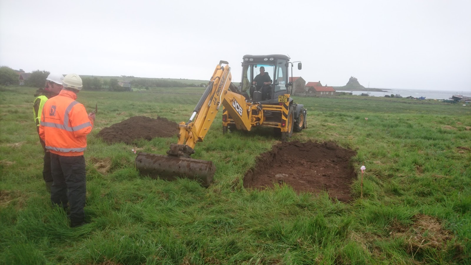
The long 18th century saw the development of the antiquarianism, both in terms of scope and methodology but also its institutional structure. First, the level of recording and fieldwork developed- building on the methods of Aubrey and others. Excavation whilst often exceptionally crude by modern standard was increasingly carried out- classically on prehistoric burial mounds. Major early excavators included figures such as the Reverend Bryan Fausett (1720-1776) and the Reverend James Douglas (1753-1819) – the former opened over 700 barrows, prehistoric and Anglo-Saxon over his career. The 18th century thus saw an increasing emergence of prehistory as a distinct sub-field, comprising both standing monuments and excavated remains.  However, whilst figures such as William Stukely – more commonly associated, like Aubrey, with work on prehistoric sites, did record medieval buildings, medieval archaeology was treated as a topic for which the main resource were standing buildings rather than a field for subsurface intervention. The motif of barrow breaking was however used by James in A Warning to the Curious although in this case in the context of an Anglo-Saxon rather than a prehistoric barrow.

A major development for the wider field of antiquarianism was the establishment of the Society of Antiquaries of London in 1707 and receiving its royal charter in 1751. This provided an institutional focus for antiquarian pursuit in England- as well as crucially being responsible for a series of journal – most notably Archaeologiaand Vetusta Monumenta  – both of which published from the very beginning material on medieval topics.

Rather topically, one of the few areas where medieval antiquities were actively investigated through excavation was the graves of kings. Particularly under the stimulus of Richard Gough, Diretor of the Society of Antiquaries from 1771 to 1797. In 1774, the tomb of Edward I was opened in Westminster Abbey revealing both the body and associated grave goods, Edward IVs grave in St George’s Chapel, Windsor, was opened in 1789, and King Johns grave excavated in Worcester Cathedral in 1797. This investigation of graves clearly finds resonances in some of James’ stories, particularly An Episode of Cathedral History- but as we shall see he also later had a more direct involvement in the opening of medieval graves.

The later Victorian saw changes in emergence of deep time- scientific understanding of prehistory particularly due to increase of excavation – drawing on notions of social evolution ultimately derived from Darwinism, but also principles of stratigraphy derived from geology, all of which profoundly influenced the development of archaeology as discipline. But the mid 19th century also saw the establishment of an increasingly structure academic framework for the archaeological study of the past. Crucially this was the great period of the flowering of national, county and local archaeological societies. A key moment was the establishment of the British Archaeological Association in 1843, in reaction to a perceived over emphasis on earlier periods of history by the SA, as well as a perception that it was London-biased and aristocratic. The aims of  the BAA were clearly “for the encouragement and prosecution of researches into the arts and monuments of the early and middle ages” . Amongst its aims were the organisation of an annual archaeological congress, along the model of the French Congrès Archéologique or the annual meetings of the British Association for the Advancement of Science. There was a rapid schism however, partly along class lines. The majority of the founders of the BAA were from trade backgrounds, but following a squabble about publication, a new Archaeological Institute was founded by a faction led by Albert Way of a notably differing class complexion.  Despite the increased ‘professionalization’ of the archaeology and antiquarian studies in this period, the remit of both societies was still very wide. The first volume of the Archaeological Journal published by the Archaeological Institute including papers on Roman London, Observations on the Primeval Antiquities of the Channel Islands, On Anglo-Saxon Architecture and, and I quote ‘The Horn-shaped Ladies’ Head-Dress in the reign of Edward I “. The term ‘archaeology’ still had a wide semantic range and in the words of Chris Gerrard “the relationship between antiquarianism, historians, architects and archaeologists was uncertain territory”.
The mid-19th century saw a huge range of other societies being established at this time – both historical- the Surtees Society 1834, the Early English Text Society 1864, the Harleian Society 1869, and archaeological –By 1886 there were some 49 county and local archaeological societies, including the Cambridge Antiquarian Society of which James became a member. It is to this kind of society that Baxter, the antiquary, in A View from a Hillseems to have belonged. The protagonist “spend a morning half lazy, half instructive in looking over the volume’s of the County Archaeological Society’s transactions in which were many contributions from Mr Baxter on finds of flint implements, Roman sites, ruins of monastic establishments – in fact most Departments of archaeology.”. In the story, Baxter was the local watch maker, and this reflects an important aspect of the widening of archaeology as a sphere of research, a process of social democratization. Even as early as the early 19th century, not all antiquarians were of aristocratic, gentry or ecclesiastical backgrounds. William Cunnington, the important early 19th century field worker was a local merchant.
A facet of many of these early societies was an increasing emphasis on campaigning to preserve and protect historic monuments- something which was not within the constitution or ambition of the Antiquaries. Despite the rampant medievalism of mid-Victorian society, with the emergence of Gothic as a natural architectural style with figures such as Pugin and Gilbert Scott in the vanguard of this taste-making, historic monuments were increasingly under threat. Indeed, it is this very resurgence of medievalism that led to a sustained attack on the historic fabric of Britain’s churches. The Oxford movement with its aim to revive and renew traditional and  more Catholic styles of worship led to an assault on the interiors of medieval  churches with later features regularly removed and stripped back to achieve an allegedly more authentic, medieval style. This movement was motivated by an enthusiasm for the medieval – the aims of the Cambridge Camden Society, so closely associated with this thrust, were “to promote the study of Ecclesiastical Architecture and Antiquities and the restoration of mutilated Architectural Remains”. However, the followers of the Camden society and its Oxford counterpart, the Oxford Society for Promoting the Study of Gothic Architecture did great harm to the historic interiors of British parish churches. Despite both his loyalties to the Victorian world  (remember if you please that I am a Victorian by birth and education…”)and his love of the medieval, James’s attitude to this medievalism was one of ambivalence. His preferred architectural style appears to have been neo-Classical, and the unconstrained and insensitive removal and reordering of the 17th and 18th century interiors of medieval cathedrals to be replaced by neo-Gothic furnishings is at the core of An Episode of Cathedral History, and the fragment of medieval stall and its associated paper message presumably came to the knowledge of the narrator following their removal from the cathedral. It was in reaction to such destruction thatWilliam Morris founded the Society for the Protection of Ancient Buildings in 1877, although the views of the ‘anti-scrape’ as it became known were not always popular.
A wider concern about the destruction of historic and archaeological monuments reached parliament and steered by Sir John Lubbock, 1st Baron Avebury, in 1882, the Ancient Monuments Protection Act was passed. Lubbock was an important figure in the development of prehistoric archaeology in Britain – heavily influenced by social Darwinism, he was writer of some of the first major syntheses of the development of prehistoric society, coining the terms Palaeolithic and Mesolithic. If the name Lubbock rings a bell for many of you, it most likely because one of the early memoirs of M R James was written by Samuel Gurney Lubbock – a nephew of John Lubbock. Monty was also friends with John Lubbocks sons, Harold and Eric. He certainly visited the Lubbock family home, where he met Baron Avebury’s second wife, Alice Pitt-Rivers, daughter of Augustus Lane-Fox Pitt-Rivers, another towering figure in late Victorian archaeology.

But how does MR James relate to this wider development of archaeological endeavour in the later 19th and early 20th century?

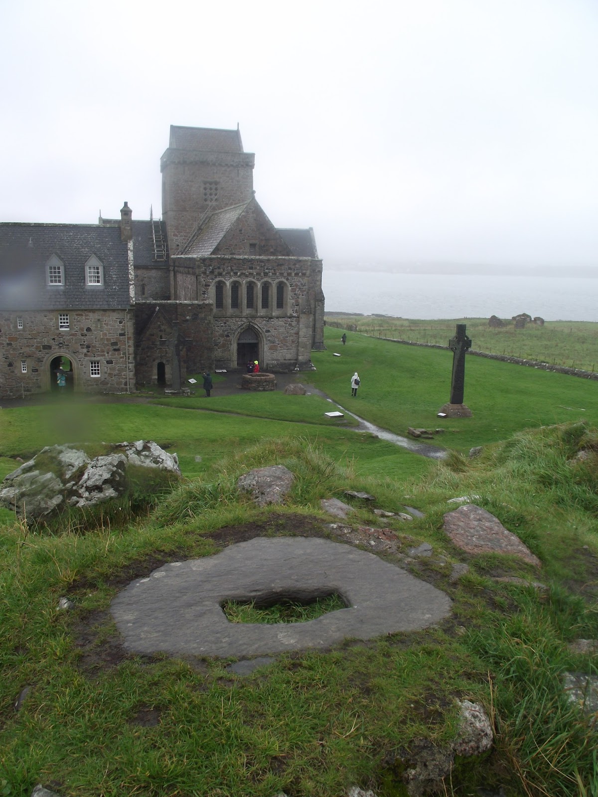
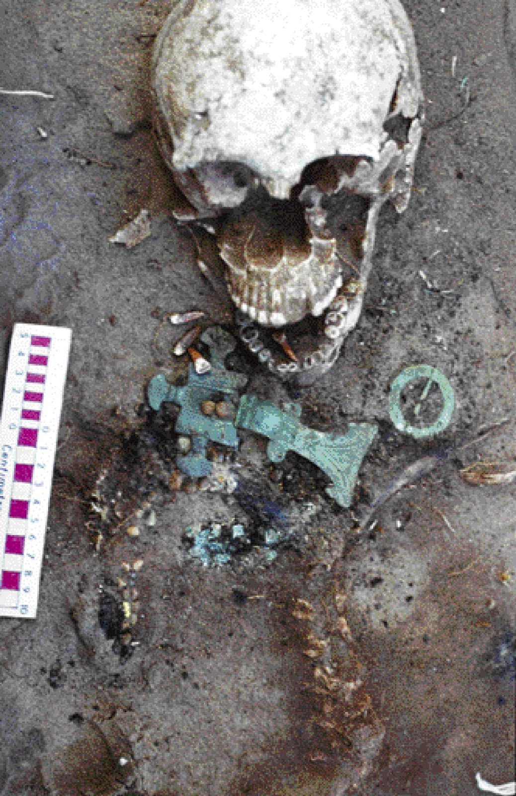
As a child he wrote to his father that he wanted “above all things to make an Archaeological search into the antiquities of Suffolk, to get everything I can for my museum” and later that he planned to “prosecute my archaeological studies at the Guild-Hall library in the holidays”. Growing up in rural Suffolk he lived in an area with a strong antiquarian tradition – indeed, the sons of one of the earlier vicar’s of Great Livermere “Honest” Tom Martin was a noted Suffolk antiquarian and the Suffolk Institute for Archaeology was founded in 1848. One possibility I  have not been able to confirm is that James knew about the excavation of the important Anglo-Saxon boat burial at Snape – probably of a member of the East Anglian royal family these burials and the associated barrows stood on the main road into Aldeburgh, where he spent much time as a child. The tumulus was obvious and is shown clearly surviving on the 1stEdition Ordnance Survey map.   It seems inconceivable that given his proclivities he was not aware of it and must have consciously or unconsciously fed into the plot of a Warning to the Curious, particularly given its setting in Seaburgh, clearly based on Aldeburgh.

Despite his occasional roof-climbing adventures, Monty had relatively little exposure to archaeology or ecclesiology at Eton. However, when he arrived at Cambridge he emerged into a city and university on the leading edge of the disciplinary development of archaeology. We might perhaps at this stage identify three key, distinct, but cross-fertilising streams in archaeology. Prehistoric archaeology, being pushed forward by Lubbock and others, medieval archaeology, which was still a blend of more scientific approaches but still heavily influenced by antiquarian and art historical perspectives, and finally, an area I’ve not yet touched on, classical archaeology. This latter field grew out of the world of classical studies and was profoundly text led and art historical, but with a commitment to excavation. Classical archaeology was in particular going through a phase of rapid development – in the decade leading up to his arrival at King’s in 1882, in particular the work of Schliemann at Troy had received international acclaim.

Cambridge University was the first British university to have an endowed chair in Archaeology- the Disney professorship set up in 1851; it required the holder to give three lectures a year for a stipend of £100. In O Whistle.. the ‘person of an antiquarian persuasion’ who encouraged Parkins to visit the site of the Templar preceptory was given, in a typical MR James in-joke, the name Disney. On his arrival at Cambridge, the holder was Percy Gardner, a specialist on Greek art , with close connections to the British Museum, but someone whose engagement in research was from the perspective of connoisseurship rather than fieldwork.
It is important to remember that MR James arrived at Cambridge to study the Classics tripos and he selected Classical Archaeology for special study in Part II of the Tripos: he wrote in 1885 ‘the field is so frightfully wide that I want all the time I can get, and not sanguine about the results. Sculpture, painting, coins, inscriptions, mythology, gems –each of these implies a good deal of reading”. Much of his learning was closely supervised by Charles Waldstein, American archaeologist and Olympic shooter who at the time was Director of the Fitzwilliam Museum,. Monty was soon appointed Assistant Director eventually succeeding to the Directorship after Waldstein, although in this position he focused primarily on the acquisition of manuscripts rather than artefacts.

It was in the domain of classical archaeology that he made his first, and most significant, engagement in field archaeology. In 1887, Henry Babington-Smith an Eton and King’s College contemporary of Monty’s was granted £150 to engage in archaeological fieldwork in Cyprus  – under the auspices of the Cyprus Exploration Fund, set up with support of the Hellenic Society. However, he instead took up a civil service job as an examiner in the education department. Monty was asked to accompany the expedition at short notice. The overall project was led by Ernest Gardner, the younger brother of Percy Gardner (Disney Professor) – who was the Director of the British School at Athens- who had excavated with Flinders Petrie. Another participant was David Hogarth, who ended up as Director of the Ashmolean Museum, and was later a close friend of T E Lawrence, for whom he was first an academic influence in Oxford and then served alongside in the Arab Bureau during WWI. Whilst Gardner was an experienced excavator, Hogarth recalled in his memoirs that the others  ‘were so raw as not to know if there were any science of the spade at all’. The focus of the excavations was the Temple of Aphrodite, but also included exploring a number of other related sites. James had two roles, on site he seems to have led with the study of the epigraphy, transcribing and translating the many inscriptions found during the work. He also provided a typically Jamesian wide-ranging and eclectic overview of the historical source material for the site, drawing on Classical texts as well as medieval and post-medieval travellers’ stories. The final results were jointly published by James, Gardner and Hogarth in the Journal of Hellenic Studies, a series edited by Percy Gardner.

It is intriguing that despite his engagement in Classical archaeology through his involvement with the Pylos excavations, his role as Assistant Director of the Fitzwilliam Museum and, by no means least, his education at Cambridge, that so little evidence of this makes its way through to his published ghost stories. Neither, despite, his friendship with the Lubbock’s does any evidence of an interest in prehistoric archaeology beyond a passing reference to prehistoric flints in a View from a Hill.

However, when it comes to medieval archaeology and physical remains, it is a different matter, both figure in the bulk of his academic work and his ghost stories. Despite being primarily remembered as a textual scholar, James’s research was not just dominated by an interest in producing edited texts, but also cataloguing –  this meant engaging with all aspects of the manuscript- not only its content, but also its physical appearance (i.e. illumination and marginalia) and provenance – in this respect it was as much an archaeological and art historical endeavour as a purely textual pursuit. In particular his fascination with hagiography and apocrypha intersected and fuelled a fascination for understanding and unpicking medieval iconography.

Surprisingly, at the age of 30, when the Disney Chair of Archaeology became empty, Monty gave serious thought to applying for it. His writings when thinking of applying and his application to the Vice Chancellor give a clear understanding of his perspective

“My object in all has been to trace, so far as I could, the historical development of sacred art from the point of view of selection and treatment of subjects, and to bring it into connexion with the literature and legends to which the artist had access/ In other words, I have worked with the view to applying to Christian art those methods which are applied nowadays to the remains of classical sculpture and painting”
 “During the last twelve years I have accumulated a very large mass of materials illustrative of Christian art and iconography. This material consists in the main of descriptions as full and accurate as I could make them, of sculpture, painted glass, pictures and illuminated manuscripts existing in a very considerable number of English and foreign churches, libraries, galleries and museums..”
This in fact fits in nicely with some of the important work done by earlier Disney chairs. The outgoing Professor George Forrest Browne had made a special study of runic stones, and published The Ilam Crosses (1889) and The Ancient Cross Shafts of Bewcastle and Ruthwell (1917). An earlier chair, Churchill Babington, had also contributed articles on medals, glass, gems and inscriptions to the Dictionary of Christian Antiquities.

What is surprising though in Monty’s unsuccessful application was how little he had published on topics even broadly related to medieval archaeology or art history. Whilst the modern publication requirements for an academic clearly did not apply in later 19th century Cambridge, this is a little disconcerting. It is hard not to draw notice to the thoughts of Parkin’s in Oh Whistle when he discovers the Templar Preceptory: ““Few people can resist the temptation to try a little amateur research in a department quite outside their own, if only for the satisfaction of showing how successful they would have been had they only taken it up seriously. Our Professor, however, if he felt something of this mean desire, was also truly anxious to oblige Mr Disney”

In fact it was in 1892, the year of his unsuccessful application, that he made his first foray in text in church archaeology despite the fact that he had been clearly exploring church art for a long time. The subject was the sculpture on the Lady Chapel at Ely Cathedral- he had declared an intent to write a monograph on this following an undergraduate visit, but it clearly took him a long time to work up to it. The sculptural programme, heavily defaced by Protestant iconoclasm, was poorly understood.  Drawing on his knowledge of apocrypha he identified the programme and read a paper to the Royal Archaeological Institute in August 1892- this was subsequently published in the Archaeological Journal, and then reworked as monograph.
Whether or not provoked by his failed attempt at the Disney Chair the 1890s and early 20th century saw Monty issuing a series of papers on topics related to church art – particularly glass and wall painting- and all with a strong element of iconographic analysis – obviously recalling the detective work of the Reverend Somerton on deciphering the message in the stained glass from Steinfeld Abbey in the Treasure of Abbot Thomas. Most of this work was published in the Reports and communications of the Cambridge Antiquarian Society– of which James was a committee member until around 1910. Unlike many of local archaeological journals, due to its University connections the Reports and Communications had a far wider purview publishing on a wide range of international topics. For example, the 1903 volume which contained a paper by James on French tapestries, also include articles on Irish folklore, Roman Britain, Aztec civilisation, Estonian harpoons, and the ruins of Rhodesia. In addition to publishing papers, he read many more to the society which were not published- sometimes two on one night. 

His involvement with the Society was important as it meant he was mixing with other important archaeologists in Cambridge and beyond- including the Disney Professor. He also saw papers read by key figures in the developing world of medieval archaeology, such as W St John Hope, with whom he later collaborated and Frederick Bligh Bond, the  notorious archaeologist and psychic whose research at Glastonbury, was he claimed, steered by his spiritualist contacts with a medieval monk of the abbey, and ultimately led to his dismissal from the excavation committee- one wonders whether the conceit of using psychical powers to see the past partly inspired a View from the Hill.
In 1901, there were plans to bring relics claiming to be the bones of St Edmund to the newly constructed Catholic Westminster Cathedral. James, along with others, wrote to The Times arguing that the provenance of these items was dubious in the extreme. Whilst some of the correspondent appear to have had a confessional perspective, James simply took issue with the use and abuse of historical records.
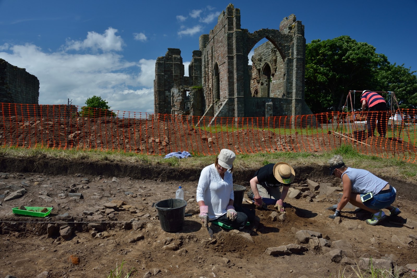
It is not clear whether directly or indirectly provoked by this debate, excavations took place in the chapter house at Bury St Edmunds, with which MR James became involved. This resulted in the discovery of a series of burials which James, using textual sources identified – this fulfilled his predictions laid out in an 1895 monograph on the church in which he suggested
“…if a systematic excavation could be undertaken, as a result of the publication of this book, I should be better repaid thereby for the pains I have spent upon it than by any other means … From the lie of the land I am inclined to believe that much of the crypt would be discovered, and that the sites of the Abbots’ tombs in the Chapter-house (including that of Abbot Sampson) might be ascertained (James 1895: 115).”. Following the excavations, he wrote to The Times re-iterating this identification- although this led to an anonymous rebuttal, also in the Letters page, followed by further support from elsewhere. Whatever the final conclusions, it is clear from the correspondence that he was not present during much of the actual excavation.
James was then again involved in a burial excavation in 1910, when the remains of Henry VI were investigated in St George’s Chapel in Windsor. This was led by W St John Hope, indefatigable excavator known for his “ungentlemanly burrowing” and his “robust” excavation techniques, who James knew from his Cambridge Antiquarian Society days. James was present in his capacity as Provost of Kings as a representative of the two colleges founded by Henry VI. The published description of the opening of the unmarked tomb in the presence of several officials, the cathedral architect and verger again calls to mind the opening of the mysterious tomb in An Episode of Cathedral History probably written a couple of years later in 1913.

Throughout his later life James continued to write about church art and archaeology although after 1910 he mostly stopped publishing in the Cambridge Antiquarian reports and communications. Instead he published his work as small monographs, such as his work on the sculptured bosses at Norwich cathedral , or in the Cambridge Review – as well as regularly writing to the The Times. He also increasingly published in the journal of the Walpole Society a new body established in 1911.
In some case, he revisited work he had previously explored- most spectacularly in the case of the Eton College Chapel wall paintings; as  school boy he had spoken in a debate declaring the destruction (as it was then though) of the paintings was ‘among the worst crimes of the century”- he had also given a paper on them in 1894 to the Cambridge Antiquarians. Finally after WWI as Provost of Eton he was able to effect the removal of the stall revealing the surviving paintings. Other work published on wall painting was done in collaboration with EW Tristram, who had been closely involved with the restoration of the Eton paintings and shows James willing to collaborate with talented younger scholars.

A final aspect of his archaeological publication are his two more popular guides- Abbeys (1926) and Norfolk and Suffolk (1930). Abbeys was a publication by the Great Western Railway and intended to help promote tourism within Britain. Both are extensively illustrated with line drawings and photographs and clearly aimed at the popular reader, and so untypically for James, there is very little critical apparatus. Instead as he willingly acknowledges he draws on his own notes, experiences and general guide books (although he does not mentioned the Bell’s Guides which get name checked in. In the short bibliography in Abbey’s he does mention antiquarian works, as well as work by colleagues and acquaintances such as Bligh Bond on Glastonbury. Whilst not academic publications they clearly key in James’ own fondness for church visiting and ecclesiology which went back to his boyhood. If not labours of love, they certainly can be seen as a contribution to the wider, more popular literature aimed at the interested amateur which James himself regularly used on his visits in Britain and beyond

To conclude- it is clear that James was engaged and informed by archaeology and archaeologist over his career. His academic research, something that Pfaff’s biography goes into in far greater depth, is at the intersection of palaeography, history, art history and archaeology. Despite his brief excursions into Classical archaeology as a young man, his engagement with the material remains of the past is solidly rooted in the medieval world. At its heart is a very text-led conviction that a thorough grasp of the textual sources – whether part of the cannon or more apocryphal or esoteric- is at the heart of the interpretation of medieval ecclesiastical decoration. Within the fairly limited scope of his archaeological work, figurative representation in ecclesiastical contexts, he was doubtless correct. He never attempted to move beyond the text, to address imagery in its own terms or widen his interests more widely into the study of military or economic history and archaeology.